Your Deed Is Just the Beginning
Title Deed Vs Reality
Did you know that holding the papers for your land is only half the story; the other half is making sure your boundaries actually line up with your neighbours? Across Syokmau, many of us hold valid deeds, yet the reality of that land often extends beyond what is captured on a registry certificate. Boundaries shift in interpretation, beacons go missing, and neighbours build fences that might not align with the map. What looks clear in a government office can feel a lot less certain when you are standing in the red dust of your own backyard.
Much of our neighbourhood traces back to a massive tract of land known as LR No. 12715. When this original parcel was carved up into individual plots, it changed everything. It was the moment we moved away from talking about “acres of bush” to owning specific, registered pieces of the map. That shift turned a shared landscape into the private plots we live on today. While each parcel now stands alone in the eyes of the law, they remain physically connected by shared roads and fences. Clarity on paper is just a legal milestone; true clarity on the ground still depends on whether your neighbours and your surveyor agree on where the line is drawn.
Bridging the Gap Between Paper and Property
Several factors cause this disconnect. In the early days of Syokimau’s growth, subdivisions weren’t always marked out with precision. Over time, as houses went up and land changed hands, original survey markers were knocked over or lost. Sometimes, “well-intentioned” adjustments to a fence line created tiny shifts that added up to big problems across multiple plots. This is why due diligence has to be more than a formality. A land search proves you have the legal right to the plot, but only a survey proves where that plot actually sits. Without both, you are not investing with facts; you’re investing with assumptions.
Understanding whether your property is freehold or leasehold is not just about the fine print—it is what defines your relationship with the county. It determines how much freedom you have to build, what fees you’ll owe, and how smoothly you can pass the land to your children or a future buyer. These aren’t just legal categories; they are the rules for how you live on and profit from your investment over the long haul.
Accuracy as a Community Strength
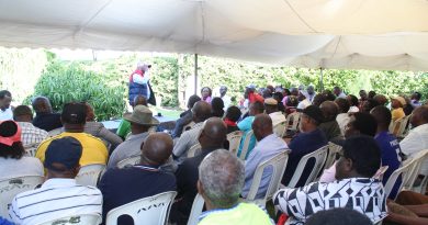
No plot in Syokimau stands alone. Every gate and fence is part of a bigger picture that includes shared roads, water lines, and community spaces. When we ignore how our land fits into this broader plan, we run into friction with neighbours or the authorities. That is why being active in the Syokimau Residents Association is so vital. It is where we swap speculation for facts and make sure our records match the reality of the street.
Today, owning land here is about more than just buying a plot; it’s about being precise. Getting your paperwork to match the actual soil is not just about protecting your own gate; it is about making the whole street a more stable place to live. When we verify our boundaries and align our papers with the actual soil, we are not just protecting our own assets—we are making the whole neighbourhood more secure. A title deed gets you through the door, but knowing your neighbours and your boundaries is what truly keeps the ground beneath your feet solid.